


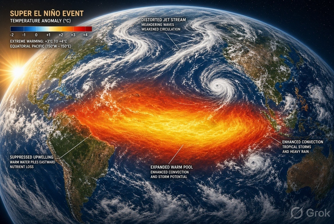

A “Super El Niño” developing in the equatorial Pacific in 2026 is intensifying at an unprecedented pace, with multi-model forecasts predicting sea surface temperature anomalies in the Niño 3.4 region to peak at ~3.6°C or higher—surpassing all previous records from 1982–83, 1997–98, and 2015–16.
Environment Pulse Desk: A “Super El Niño” has become one of the biggest climate talking points of 2026, and for good reason. The event currently developing in the equatorial Pacific is intensifying at a pace scientists describe as extraordinary, and it’s now widely expected to become the strongest El Niño ever recorded in the modern instrumental era — potentially by a significant margin.
The ripple effects, experts warn, could touch everything from global temperatures and extreme weather to agriculture, ecosystems, and economies worldwide.
What Exactly Is a Super El Niño?
El Niño refers to the warm phase of the El Niño-Southern Oscillation (ENSO), a naturally occurring climate pattern driven by shifting sea surface temperatures and atmospheric pressure across the tropical Pacific.
It typically shows up every two to seven years. When sea surface temperature anomalies in key monitoring zones — particularly the Niño 3.4 region — climb to or beyond roughly +2.0°C above average, the event earns the informal but widely used label of a “super” or “very strong” El Niño.
These are genuinely rare occurrences. The most notable modern examples came in 1982–83, 1997–98, and 2015–16. What’s striking about the 2026 event is that it blew past the thresholds for “strong” conditions earlier than any of those previous major episodes, and it hasn’t slowed down since.
An Unusually Rapid Intensification By mid-to-late summer 2026, the numbers had scientists sitting up and taking notice. Weekly sea surface temperature anomalies across parts of the eastern and central Pacific surpassed levels seen at equivalent stages of past record-breaking events, with coastal areas off South America showing even sharper spikes.
NOAA and other monitoring agencies confirmed that several metrics were already sitting in or near very-strong territory. Dynamical climate models — drawing on hundreds of ensemble runs — have converged on a peak likely to exceed all previous records, with multi-model medians pointing toward a Niño 3.4 peak around 3.6°C or higher, roughly 0.8°C above the previous high of about 2.75°C set during 2015–16.
The probability of this turning into a genuinely record-setting event has climbed to somewhere between 70 and 90 percent in successive forecast updates, with high confidence that it will rank among the strongest since at least 1950.
Some researchers have even extended the historical comparison further back, suggesting it could rival or surpass the devastating 1877–78 event, which was linked to widespread famine.
Why Scientists Are Calling It “Uncharted Territory”
The sheer strength of the forecast is what’s driving so much attention. Model agreement on this event has been unusually consistent, and climate scientists have described its early development in strikingly blunt terms — calling it “uncharted territory” given how fast and intense it has been compared to historical patterns. NOAA’s Climate Prediction Center and other forecasting bodies have raised their probabilities for a very strong event peaking sometime between late fall and early winter 2026–27, with strong odds it will persist well into spring 2027.
Independent analyses, including from Berkeley Earth, have repeatedly revised their intensity expectations upward as fresh observations kept confirming the trend. What It Means for Global Temperatures One of the biggest reasons this event matters so much is its likely effect on global temperatures. Strong El Niño events release enormous amounts of heat stored in the ocean into the atmosphere, temporarily pushing global average surface temperatures up by several tenths of a degree Celsius, layered on top of the long-term warming trend driven by human activity.
Forecasts currently point to a high probability that 2027 will set a new global temperature record, with elevated odds of extreme heat across many regions. This is especially concerning given that oceans are already running at record warmth following several years of exceptional heat — meaning the added El Niño boost could intensify heatwaves, marine heatwaves, and the health and infrastructure stress that comes with them.
Weather Disruptions Around the World Super El Niño events don’t just raise temperatures — they reshape weather patterns globally by shifting the jet stream, altering monsoon behaviour, and rearranging rainfall distribution far more dramatically than weaker events.
Some of the expected impacts include:
- Wetter-than-normal conditions and flood risk in parts of the southern United States, southeastern South America, East Africa, and the west coast of South America, including Peru, Ecuador, and Chile. • Drier conditions and heightened drought and wildfire risk across Australia, Indonesia, parts of Southeast Asia, southern Africa, northern South America, and India — where the southwest monsoon could weaken as a result.
- Shifts in tropical cyclone activity, with storms often intensifying in the central and eastern Pacific while activity in the Atlantic tends to be suppressed due to increased wind shear.
- Broader ecological and economic fallout, including large-scale coral bleaching, disruption to fisheries (particularly off Peru), and knock-on effects for food production, water supplies, and the spread of disease vectors such as mosquito-borne illnesses in certain regions. Lessons From Past Super El Niños History gives a fairly sobering picture of what’s potentially at stake. The 1997–98 event caused trillions of dollars in economic damage in the years that followed, contributed to widespread coral mortality — with some estimates suggesting around 16 percent of reefs were affected — and led to significant loss of life tied to weather extremes.
Further back, the 1877–78 event was linked to famines that killed tens of millions of people.
Even the more recent 2015–16 event brought major droughts, floods, and temperature records of its own. Given that the 2026 event is projected to exceed all of these in intensity, it’s no surprise that governments, insurers, agricultural industries, and emergency planners are watching closely, bracing for potential cascading risks such as crop failures, supply-chain disruptions, migration pressures, and broader economic losses.
A Climate System Without a Clear Precedent
What’s adding to the scientific and public interest is the way natural variability is now interacting with human-driven climate change.
Researchers believe background ocean warming may be contributing to the sheer scale of this event, and many note that the climate system is essentially entering territory without a precise modern comparison.
There’s still uncertainty around the exact peak intensity and the full range of impacts — after all, no two El Niños unfold identically — but the overall trajectory has been consistent enough to keep this story firmly in the spotlight.
Agencies continue to release regular updates, with interactive trackers and model ensembles publicly available, and scientists have been unusually direct in communicating the stakes, with some describing the event’s potential strength as nothing short of “mind-blowing.”
In short, this isn’t shaping up to be a routine El Niño year. The rapid early intensification, the near-unanimous model signals pointing to record or near-record strength, the expected spike in global temperatures, and the possibility of amplified extreme weather across multiple continents have all pushed this from a technical forecasting story into a topic drawing attention from scientists, policymakers, media, and the general public alike.
Monitoring will continue as the event approaches its peak later in 2026, with its full effects expected to play out well into 2027 and beyond.
Also Read: The World Isn’t Debating Climate Change Anymore, It’s Debating How Fast to Fix It