


India is transforming its approach to flood management by shifting away from traditional concrete embankments toward advanced science, technology, and ecological restoration. Driven by severe monsoon crises—such as the record-breaking floods in Assam and Patna—scientists are utilizing ISRO’s radar satellites (RISAT) to track inundation through cloud cover and provide early warnings. On the ground, institutions like IITs and the National Institute of Hydrology are deploying IoT sensors, AI models, and hill-slope monitors for real-time risk assessment. Modern flood mitigation now emphasizes “living with floods” through bio-engineered embankments using vetiver grass, wetland and floodplain restoration, artificial highlands for wildlife, and climate-resilient infrastructure like stilt housing and permeable roads. Despite these technological leaps, challenges remain regarding sparse ground-level rainfall data, livelihood-focused policies, and interstate data-sharing. Ultimately, experts emphasize that while satellites and sensors offer critical intelligence, sustainable flood resilience requires better land use and ecological respect.
Environment Pulse Desk: For decades, flood mitigation in India meant one thing: more embankments, more sandbags. Today, the fight is moving to labs, space centres, and riverbeds. From ISRO’s radar satellites that see through monsoon clouds to IIT scientists who grow embankments with grass, Indian science is trying to rewrite how a flood-prone country lives with water.
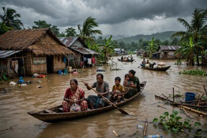
And it needs to. In September 2026 alone, rivers breached their Highest Flood Level (HFL) at 25 locations. At Pandarak in Patna, the Ganga rose to 43.92m, beating its 2021 record and staying above danger for 78 hours. In Assam, what should have been a routine two-year rainfall event displaced 7.21 lakh people.
Here is how Indian scientists are stepping in.
From Space: ISRO’s Eye That Sees Through Clouds
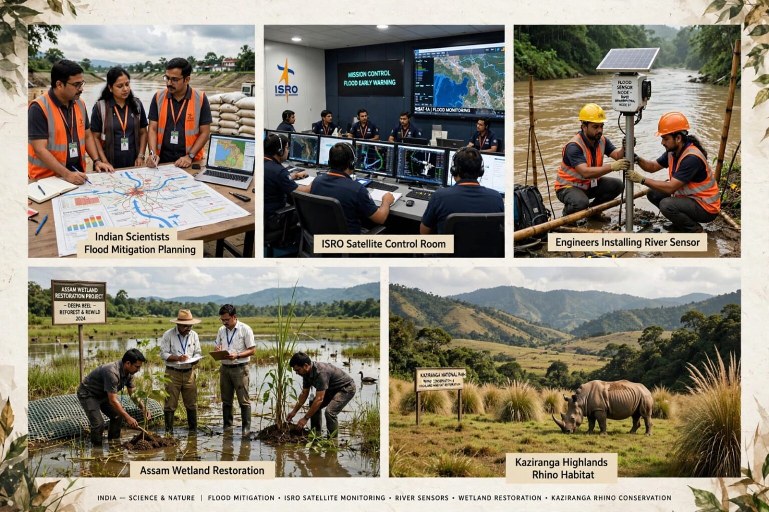
Traditional optical satellites go blind during the monsoon. India’s game-changer is the RISAT (Radar Imaging Satellite) series. It uses Synthetic Aperture Radar (SAR) that penetrates thick cloud cover and maps inundation in near real-time, even at midnight.
Scientists at ISRO’s National Remote Sensing Centre (NRSC) and the Space Applications Centre, Ahmedabad, feed this data into the Bhuvan Geo-portal. The Central Water Commission (CWC) gets a 24-to-72-hour head start on where the flood crest will travel.
During the 2026 Assam floods, this system was critical. ISRO’s flood hazard atlas and telemetry allowed the Assam State Disaster Management Authority (ASDMA) to pre-plan rescue routes for Upper Assam districts like Sivasagar and Charaideo, which had never seen such flooding before. For a country where World Weather Attribution noted that ground rainfall data is sparse, space-based data is filling a life-saving gap.
From The Ground: IoT Sensors, AI, and Early Warning
Scientists at IIT Roorkee, IIT Guwahati, and the National Institute of Hydrology (NIH) are building a dense network of low-cost sensors.
– River level sensors: Ultrasonic sensors tied to LoRaWAN networks send water level data every 15 minutes from remote Himalayan tributaries in Arunachal and Nagaland. The lesson from 2026 was clear: rain in Nagaland’s hills becomes a crisis 300 km downstream in Assam within hours. Now, upstream-downstream linking is being automated.
– Landslide and hill-cutting monitors: In Uttarakhand, after the Dharali-Harsil cloudburst of August 2025, Wadia Institute of Himalayan Geology installed soil moisture and slope movement sensors. When soil saturation crosses 85%, an automatic alert goes to the district.
– AI models: IIT Delhi’s Centre for Atmospheric Sciences and IMD Pune are using machine learning on 40 years of rainfall and river discharge data to predict not just rainfall, but where water will log. Unlike old flood models that only predicted river flow, these models account for encroached beels (wetlands), silted channels, and blocked drains.
From The Riverbed: Rethinking The Embankment Obsession
For 70 years, India’s answer was concrete embankments. Assam has over 5,000 km of them. Scientists now say they often make floods worse. The Brahmaputra carries huge sediment from the Himalayas. Embankments trap it, the riverbed rises, and when an embankment breaches, the damage is catastrophic.
The new science is called “Living with Floods” and is being pushed by the National Disaster Management Authority (NDMA):
– Restoring floodplains and beels: Researchers at Cotton University, Guwahati, and the Wildlife Institute of India have mapped how Assam’s 1,200+ beels can store billions of litres if encroachments are cleared. A pilot in Deepor Beel near Guwahati showed restored wetland storage reduced local flooding by 18%.
– Bio-engineering embankments: Instead of concrete, scientists at IIT Guwahati and Assam Agricultural University are using vetiver grass, bamboo geotextiles, and coir mats. The roots hold soil, water passes slowly, and the structure doesn’t collapse like concrete.
– Highlands for both humans and rhinos: In Kaziranga, the forest department, with help from WII scientists, built over 140 artificial highlands. During floods, these 8-10m high mounds become islands for rhinos, elephants, and sometimes for villagers too. On NH-715, sensor-based speed control automatically slows traffic when animal movement is detected during floods – a perfect blend of ecology and engineering.
From The Lab: Climate-Resilient Infrastructure
NDMA’s new guidelines, drafted with scientists from IIT Bombay and the Central Building Research Institute (CBRI), mandate:
– Stilt housing: In Bihar’s Supaul and Assam’s Dhemaji, prototype houses on 8-foot stilts with flood-resistant bamboo-composite walls are being tested. They cost only 12% more than normal houses.
– Permeable roads: Instead of sealing the ground, new rural roads in Odisha’s flood zones use interlocking permeable concrete that lets water seep through and recharge groundwater.
– Root-rot science for farmers: The 2026 floods caused an 8% drop in Assam tea production due to waterlogging-induced root rot that will affect crops for two seasons. Scientists at Tocklai Tea Research Institute have now developed a bio-fungicide and early drainage advisory that is being sent via WhatsApp to 140,000 small tea growers.
The Unfinished Science: What Still Needs Fixing
Scientists themselves are candid. The biggest gap is still ground data. As WWA’s August assessment of Assam floods noted, “evidence is uncertain because rainfall observations in the region are sparse.” India has one rain gauge per 500 sq km in the Northeast; the WMO recommends one per 100 sq km.
Second, social science is lagging behind space science. As Policy Circle wrote in its analysis “Assam floods expose the limits of relief-first approach,” flood policy must focus on livelihoods. Saving a life with a satellite is vital, but if that person loses his tea garden job for six months, he remains vulnerable.
Third, inter-state science. A river doesn’t respect state boundaries. The Counterview analysis of the 2026 floods argued for a Brahmaputra basin authority where data from Nagaland, Arunachal, Assam, and even Bhutan is shared in real time. That political agreement is still pending.
India’s scientists have moved the needle from “flood control” to “flood intelligence.” We can now see a flood coming from space, feel it on a hillside sensor, and give people an extra 72 hours.
But the hardest lesson is not technological. It is ecological: you cannot engineer your way out of a flood if you have concretized the wetlands that absorbed it and deforested the hills that slowed it.
As one ISRO scientist put it: “Our satellites can show you where the water will go. But only better land use can give the water a safe place to go.”
The next big flood will test not just our sensors, but whether we listened to what they told us.
Also Read: ANALYSIS: The Carbon Footprint of War — How Global Conflicts Are Fueling Climate Change